LandMon
LandMon – Exploitation of next generation satellite missions for operational land monitoring
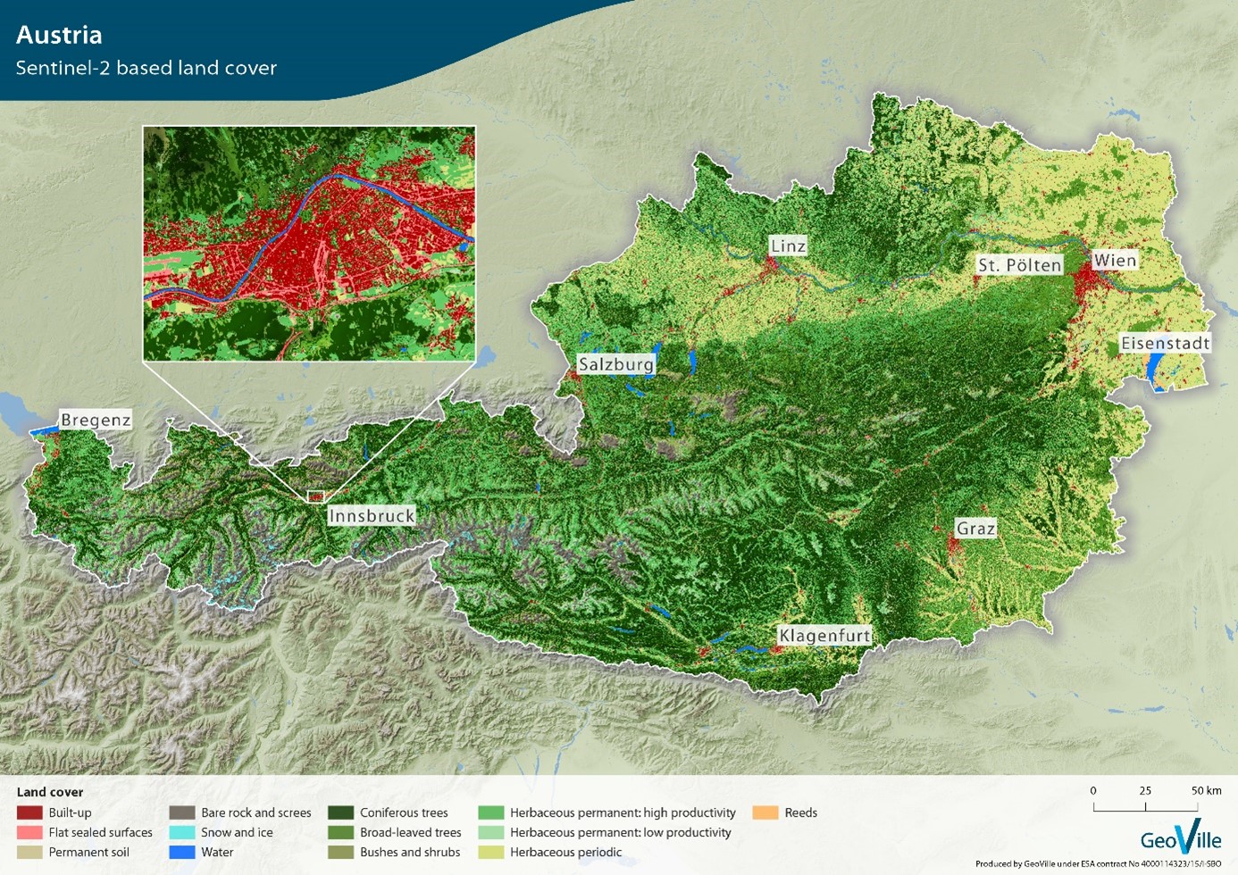
Next generation satellite systems provide a novel coherent satellite-based land information mapping capacity and have the potential to change the static mapping procedures to enable a more continuous land monitoring. The aim of LandMon was the development and validation of revolutionary processing methods to facilitate and support efficient and regular production of pan-European land monitoring data with S-2 data and the demonstration to the European Environment Agency (EEA) of a fully automated land cover monitoring capacity in high spatial resolution, facilitating timely analysis and reporting.
LandMon enabled the development of bio-physical indices, a phenological pattern recognition, as well as development of revolutionary processing methods to facilitate and support efficient and regular production of pan-European land monitoring data with dense time-series of Sentinel-2 data. LandMon demonstrated an automated land cover monitoring capacity in high spatial resolution, facilitating timely analysis and reporting, addressing observable habitats, ecosystems and related change processes on the Earth’s land and coastal areas, such as urbanization, deforestation, agricultural intensification, water resource use, natural hazards and climate change impacts.