Suitability of mixed-satellite-sensor derived 3D data for rapid urban population estimation in crisis situations
In this project, we wanted to know if, in the absence of dedicated stereo pairs, cross-orbit, mixed-time and/or mixed sensor stereo pairs could be used to produce digital elevation models. These models would then be used for population estimation and damage assessment. The project was a cooperation with Uni Geneva/GRID and DLR.
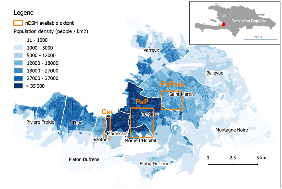
Population estimation in the absence of up-to-date census data relies on satellite images to estimate the number of housing units, which in turn is used to calculate the total population. In areas with multistory buildings, 3D data improves this process, but these data are often not available. Here we tested methods to create 3D data from image pairs that were not taken at the same day. While these data have some shortcomings, they can still be valuable for population estimation.