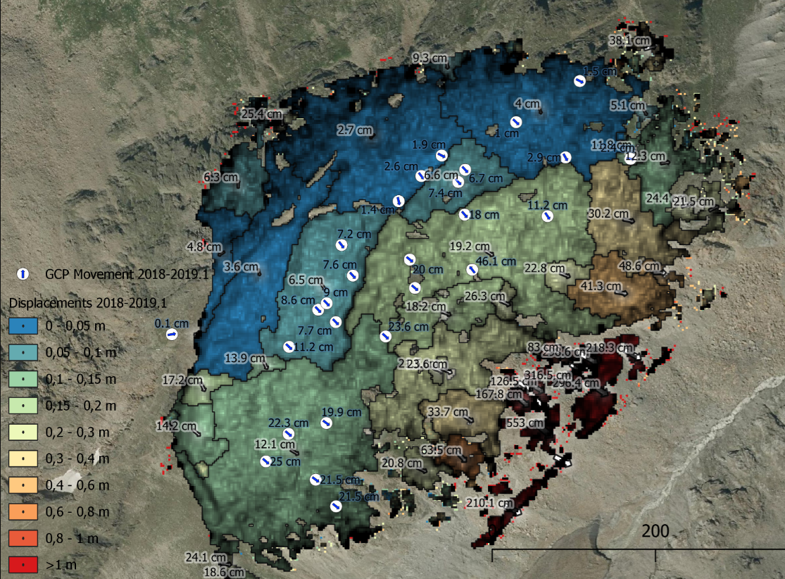
Monitoring slope deformations with InSAR (Interferometric Synthetic Aperture Radar) and unmanned aerial vehicle photogrammetry
The activity status of slope deformations in bedrock is often unclear, because of their slow movement of only a few mm-cm/yr and inventories in Europe being incomplete. In order to capture the acceleration of slope deformations, a retrospective view into the activity status is needed and this is often missing, as often the slopes in question are only detected when they are already in an acceleration state. However, for the evaluation of the failure and hazard potential, the average deformation rate and the potential acceleration rates are of crucial importance.
The Vigilans project has developed methodological workflows using satellite radar and drone photogrammetry that have achieved a TRL 5 to both retrospectively detect slope deformations in demonstration areas and analyse time series to detect acceleration phases.