smartEarth - Bridging the information gap with space-based analytics
Evaluating Earth Observation Data and Deep Learning Methods to Support Landscape Disturbance Mapping.
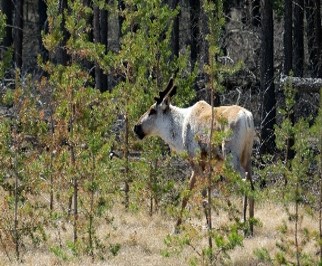
The EO-DL4DM project aims to assess artificial intelligence deep learning techniques to map cumulative linear disturbances on natural landscapes using high- and moderate-resolution EO data, such as Sentinel-2, SPOT-5, and Landsat. These deep learning techniques were tested for scalability using cloud-computing platform enabled with graphical processing units (GPUs). The results of the EO-DL4DM project were a proof of concept in the use of deep neural network techniques to detect and extract a contemporary disturbance data set across large areas within Caribou heard ranges.
Target:
Organization:
CSA
Directorate:
Space Utilization / smartEarth
Keywords:
Caribou
Conservation
Deforestation
Degradation
Linear
Restoration
Regions:
North America
Project/Program:
smartEarth Enabler
Type:
Digital Platform Services
Status:
Completed