"Flooding is the most frequent and damaging natural disaster in Canada. Every year, floods cause more than 1 billion dollar in damage. These costs are expected to triple by 2030 due to climate change. The development of knowledge and the preparation regarding these risks among governments, Insurance compnies, and the general public are among the biggest challenges related to this issue.
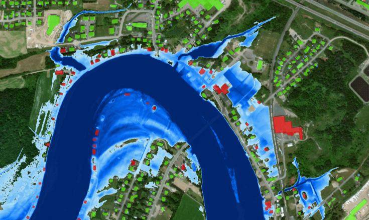
This project will make a significant contribution to improving knowledge and management of flood risks. By integrating optical and radar satellite imagery data, the project will make it possible to identify flood zones and map floods in almost real time. The project has three objectives : Large-scale deployment and validation of an innovative method of flood delineation using optical satellite imagery; Large-scale deployment and validation of an innovative method for regionalizing flood flow quantiles, taking advantage of various earth observation data and geospatial approach with radar imagery for the delineation of the extent of flooding in near real time.
These advances will not only help decision-makers gain a comprehensive and up-to-date view of risks in order to take preventive action and optimize interventions but will also help insurers better assess the risks their clients are facing. The general public will be better able to stay safe and become more resilient to this natural hazard, especially in the context of climate change."
![]()