EO-based services to support humanitarian operations: monitoring population and natural resources in refugee/IDP (internally displaced person) camps
The overall objective of this project was to develop operational, EO-based information services and bespoke products, in support to humanitarian action and relief support. These services include the mapping of new settlements and their buildings as a basis for planning and population estimation, the monitoring of the landscape around settlements, which might have an impact on the supply of firewood, the suitability for food production (agriculture and grazing) and the spread of vector-borne diseases such as Malaria. The project also used remote sensing to support groundwater exploration.
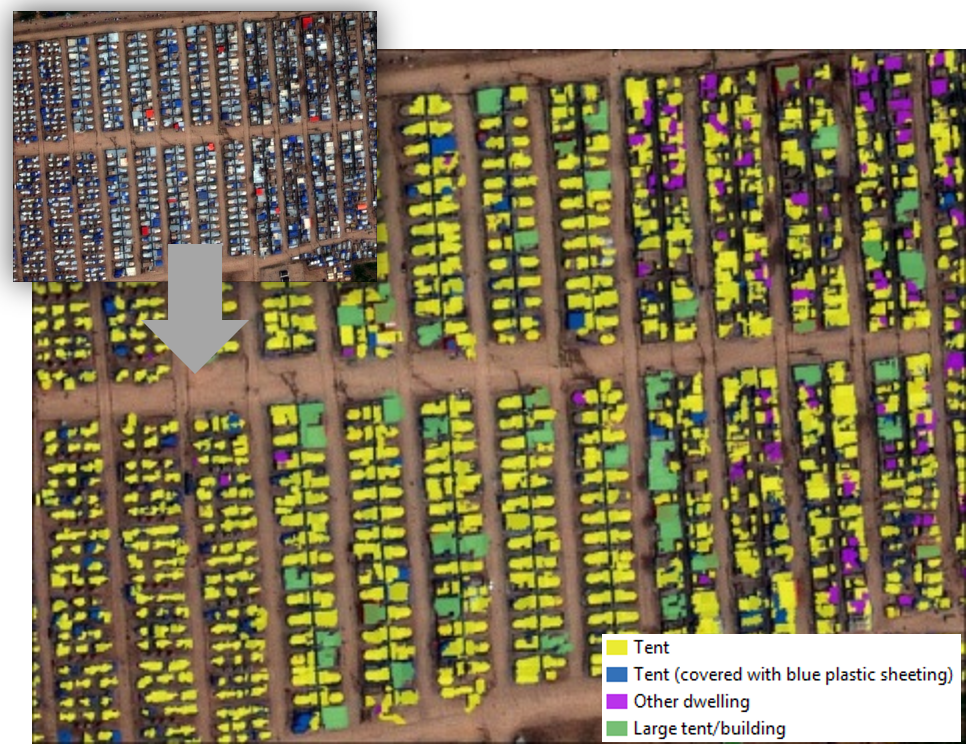
Remote sensing allows mapping settlements and their surroundings accurately, without the need for extended fieldwork, which might be dangerous or impossible. The logistical simplicity of observing and monitoring without equipment like drones locally required is unparalleled. Satellite images allow for a regular update over large area. The maps are the basis for infrastructure and service planning, population estimation, medical supply needs estimation, vaccination campaigns, or spraying against Malaria-transmitting insects. The main user of these services are humanitarian organisations.