Innovative multi-temporal unmixing approaches for monitoring fire-prone ecosystems with EnMAP
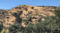
EnFireMap project makes use of EnMAP (Environmental Mapping and Analysis Program) time series to address monitoring needs in fire-prone ecosystems. The project focuses on five Californian study sites, which are characterized by various vegetation communities, diverse environmental gradients and almost annually recurring fires. Specific objectives are (1) to advance quantitative machine learning workflows to leverage the benefits of intra-annual and multi-year hyperspectral EnMAP time series, (2) to quantify ecosystem parameters relevant for pre-fire risk and post-fire impact assessment, and (3) to improve the understanding of post-fire vegetation recovery processes through synergistic analyses with multispectral Landsat/Sentinel-2 time series. Post-fire analyses will be supported by in situ surveys and field photography. Through this work, the potential of hyperspectral satellite missions for deriving more detailed and accurate environmental parameters relevant to describe pre and post fire dynamics will be shown.