activity - Wed, 13/12/2023 - 14:44
Artificial Intelligence for Automated Mapping of Land Use and Land Cover.
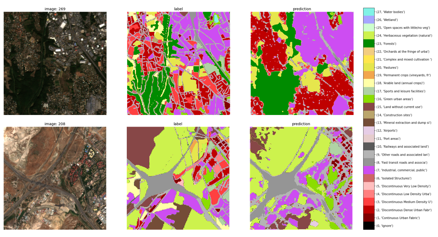
Land use and land cover (LULC) information is an important fundament for planning of sustainable urban development. AI4LULC will contribute to innovative and automated LULC mapping methods based on state-of-the-art machine and deep learning paradigms, where training is based on Copernicus data such as Sentinel-1, Sentintel-2, or the VHR Image Mosaic. Global, pan-European, and national use cases are taken into consideration to demonstrate the scalability of the approach and to boost the scientific and economic exploitation potential.
Target:
Organization:
Austria in Space
Keywords:
AI
Machine Learning
Urban
Regions:
Global
Type:
Project
Status:
Completed