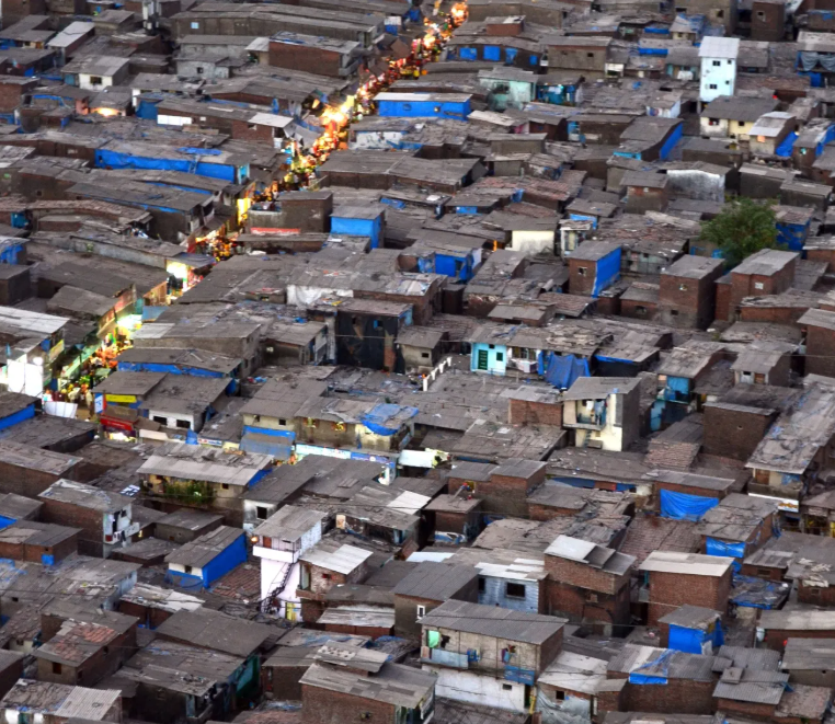
According to the World Bank, over 1 billion people live in slums or informal settlements, a number projected to double by 2050 if current urbanization trends continue. IDEAtlas uses AI and satellite data to map and monitor slums, helping cities plan better and improve living conditions in informal settlements.
Source : World Bank
IDEAtlas is a project in close collaboration with UN-Habitat and the IDEAMAPS Network. The project develops AI-powered Earth Observation (EO) methods to monitor informal settlements and support data-driven urban development.
The project focuses on creating robust, scalable, and automated methodologies to map slums and analyze their:
-
Extent and physical characteristics (e.g. slum morphology),
-
Temporal dynamics (expansion and densification),
-
Living conditions (through a deprivation index),
-
Urban-scale metrics such as slum severity and population estimates.
By leveraging both freely available Sentinel-1 and Sentinel-2 satellite imagery and Very High Resolution (VHR) commercial data, IDEAtlas aims to deliver cost-effective, up-to-date monitoring solutions for cities worldwide.
The project is developed in eight pilot cities: Mexico City, Nairobi, Lagos, São Salvador da Bahia, Jakarta, Medellin, Mumbai, and Buenos Aires.