HeatAdapt
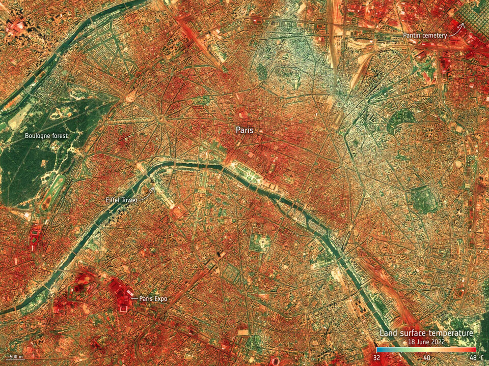
Extreme heat events are increasing in Europe, with urban areas experiencing up to 10°C higher surface temperatures due to the Urban Heat Island (UHI) effect. In Austria, this is a growing concern, especially in densely built-up regions. The HeatAdapt project addresses rising urban temperatures and heat-related risks by providing AI-enhanced satellite tools that help urban planners simulate land use impacts and implement effective strategies to reduce the Urban Heat Island effect.
Source : European Commission
HeatAdapt is a project contributing to the Green Transition Information Factory (GTIF) demonstrator for Austria. The main goal of the project is to assess the connection between land use and land cover (LULC) changes and the impact of heat, specifically addressing the Urban Heat Island (UHI) effect. This effect is responsible for significantly raising surface temperatures in urban areas, leading to increased health risks and energy consumption.
Using satellite-based Land Surface Temperature (LST) data, the project aimed to create advanced tools that could simulate how changes in land cover and land use influence urban heat levels. The core of the project involved downscaling LST data using AI techniques, which enabled more accurate and localized analysis. This downscaled data formed the foundation for a simulation tool that assessed the impact of various urban planning scenarios on temperature regulation, such as increasing green spaces or reducing impervious surfaces like concrete.
Another key outcome of the project was the development of a heat vulnerability index. This index combined population density data with LST data, providing a clearer picture of which areas are most vulnerable to heat stress under different climate scenarios. By examining the relationship between temperature variations and urban land cover, the project also refined tools to better understand how impervious surfaces contribute to higher heat levels in cities.
In the final phase of the project, the developed tools and methods were successfully integrated into the GTIF Austria demonstrator platform, allowing for further use by local stakeholders, such as urban planners and policymakers.