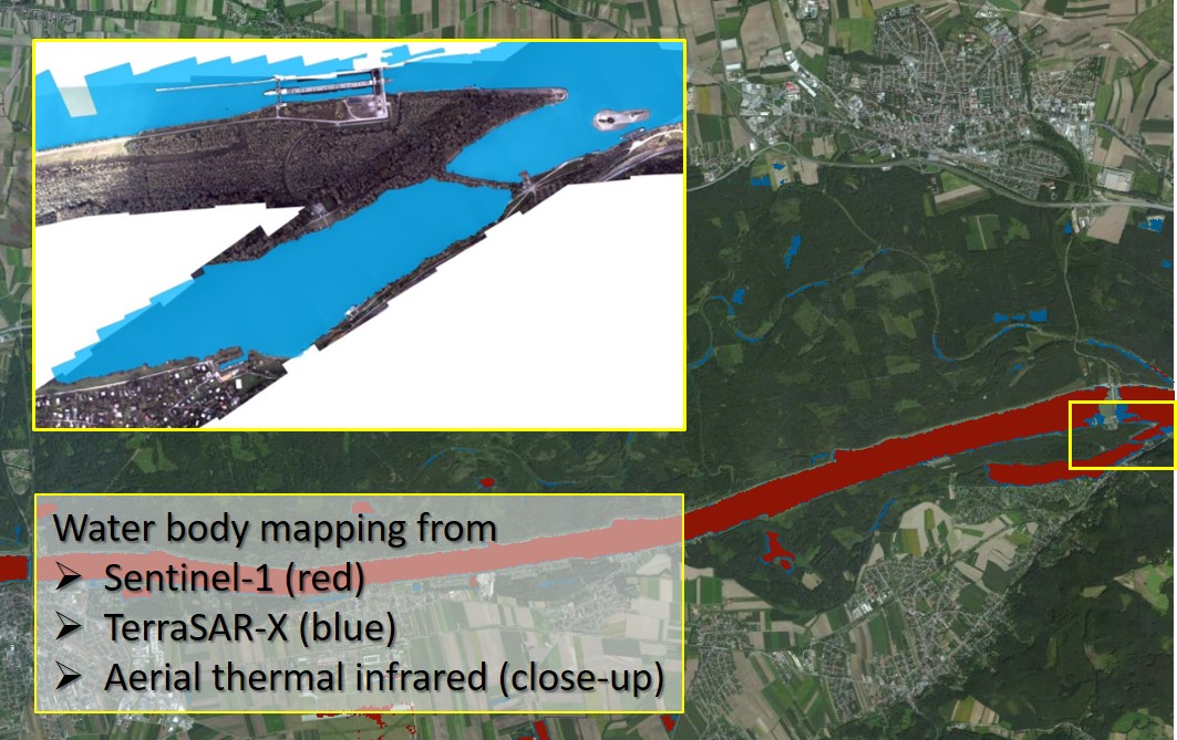
Comprehensive And Rapid Information Provision for Efficient Disaster and Emergency Management
Comprehensive mapping services were developed to support disaster and emergency management authorities, in particular with respect to hydrological disaster events. Based upon satellite as well as aerial image data, covering SAR (Synthetic Aperture Radar), optical and thermal information, the focus was put on the rapid provision of products and information with respect to the extent of flooded regions. The services include large area mapping of flooded regions from spaceborne SAR data in small scale, while aerial mapping on demand can provide hotspot mapping products in large scale and in real time. The services are complementary but may be linked to existing initiatives, like the European Copernicus emergency services or the Austrian Crisis and Disaster Protection Management SKKM 2020 shall be established.
Weather-induced catastrophes frequently use to cause a high death toll and enormous economic damage. Since 1998, floods all across Europe have caused some 700 deaths, the displacement of about half a million people and at least € 25 billion in insured economic losses. Exemplarily, in Austria extended sections of the Danube River have been affected by floods, most severely in 2002 and 2013. Image information acquired from space or from aerial mapping can provide a rapid and comprehensive overview of such large areas, and thus offer helpful information for disaster management authorities and decision support prior to, during and after a disaster event.