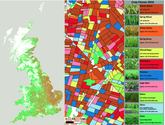
Forecasting agricultural productivity to improve agricultural supply chains
Land Cover plus Crops is a solution developed to provide detailed annually updated crop maps of Great Britain using Earth observation (EO) data. It provides parcel-level information based on a time series of free Sentinel-1 radar and Sentinel-2 optical satellite data for every individual field in the country. It is now being applied in developing countries to offer improved understanding of agricultural land use and farming practices. Maps and statistics on the location, extent, type, and variability of crops will help key users in government such as Ministries of Agriculture or Environment to predict production levels, facilitate adaptation to climate change and maintain levels of food security nationally through appropriate interventions.


