activity - Fri, 11/12/2020 - 10:22
Improving tropical forests management and detecting illegal logging in near real time
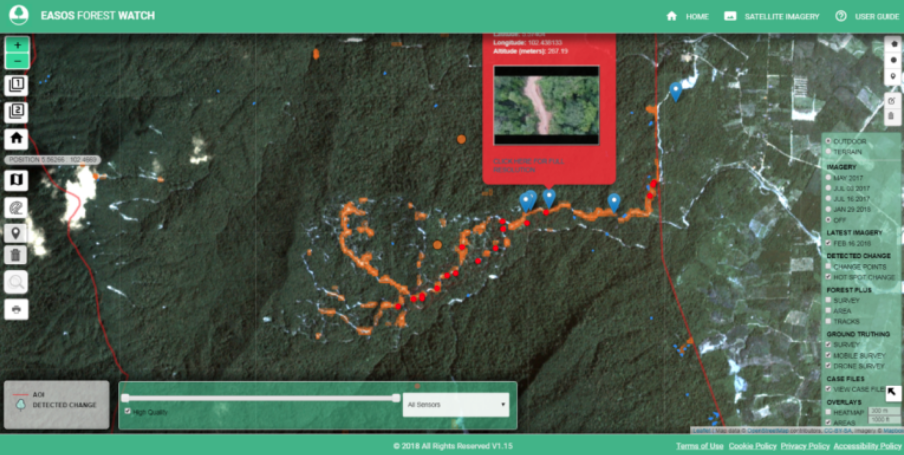
Forest Change Mapping is designed to facilitate better management of tropical forests and find illegal logging in near real time by highlighting areas of change and using these changes to create alerts and prioritise regions of action. It utilises high resolution radar Earth observation (EO) data that allow mapping in night time and are unaffected by cloudy conditions which often plague the use of optical Earth observation (EO) data in tropical and/or cloudy regions. The forest change mapping service is targeted at government users, and state level actors, interested in tropical forests.
Organization:
UKSA
Keywords:
Deforestation
Forestry
Illegal activities
Land Management
Regions:
Latin America and the Caribbean
Type:
Digital Platform Services
Status:
Completed