A cloud-based, automated surface deformation mapping framework using artificial neural networks and radar interferometry: Steps toward commercializing RADARSAT Constellation Mission data
Satellite based subsidence monitoring, powered by AI.
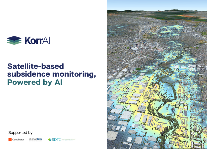
"KorrAI, in collaboration with the Canadian Space Agency (CSA), is actively working to unlock the potential of vast Earth Observation (EO) data stored in archives worldwide. This ongoing project is positioning Canada at the forefront of the next technology and science revolution.
A central challenge being tackled is the roadblocks in the radar data value chain, which have limited their application in fields such as mining, environmental services, climate resilience, and property insurance. Particularly for property insurance, an industry heavily reliant on accurate data, KorrAI's sophisticated risk maps can enhance property risk assessments linked to land subsidence and climate changes.
Currently, KorrAI is developing user-ready radar products derived from top-tier radar missions, including RADARSAT-1, RADARSAT Constellation (RCM), and Sentinel missions. These products aim to turn a massive pool of radar data into actionable insights, driving intelligent decision-making across industries.
In essence, KorrAI's ongoing project is fueling business competitiveness, enhancing climate resilience, and revolutionizing property insurance through data-driven strategies in a rapidly changing world."